It’s been almost exactly two months since Garmin announced Garmin Connect+, the sparkle-anointed subscription platform that adds a handful of additional features to your Garmin Connect experience (both on desktop and mobile). At launch, as I noted, it didn’t seem to offer a strong enough value proposition, at least to me and my needs.
But Garmin said to give it time, as it would soon expand it, and improve components like the AI insights. Thus today marks the next new subscription feature: Trails.
In short, Garmin Trails is a mapping and routing feature that finds routes while you scroll about a map (within a new ’Trails’ section on both app and web). You can filter these routes by a number of parameters, and then send them immediately to your device. To be super clear, this does not replace or remove the existing ability to create your own routes, search heat maps, or anything else that exists today on Garmin Connect. That all remains, and is free. There is no loss of features here.
Instead, think of this roughly like what portions of Strava Routes does, or Komoot does, in terms of surfacing up specific trails/routes to you, including ratings, difficulty levels, and even whether or not they have flowers or require a permit. These routes can then be pushed to your device for navigation, or saved to your account for later reference.
Now, eager to try things out, I started off looking for trails around my home in Spain. But sadly, at the nearest default zoom level, nothing was showing up. So, I zoomed out a bit (despite living on a national park packed full of running/hiking/cycling trails). Still, nothing. Then, I zoomed out to the entire island of Mallorca…nothing.
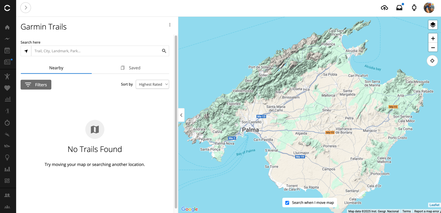
There are apparently no trails in Mallorca. Noted.
Ok, let’s reset. We’ll go to Amsterdam and surrounding areas, where I’ve been most of this week.
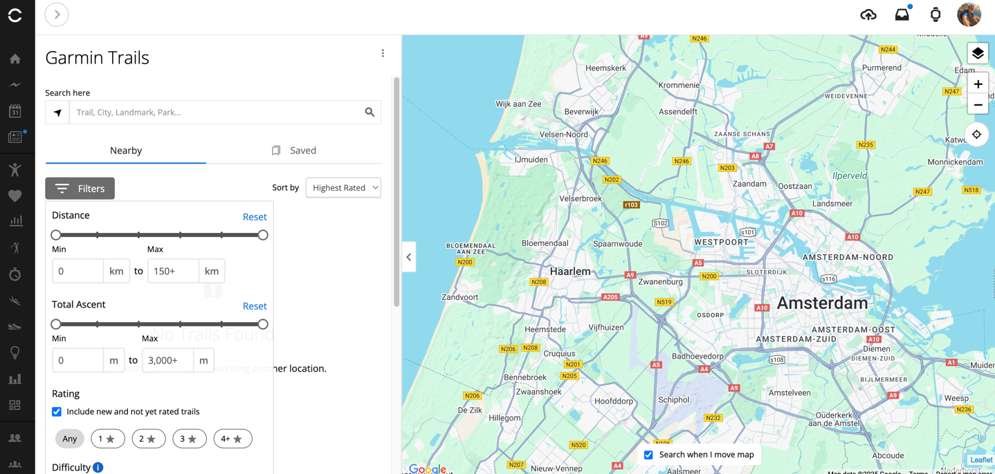
Ok then, maybe not. Perhaps I need to go into the dunes national park area, packed with trails that Dutch people wander in hopes of climbing the next best thing to real mountains: sand mountains.
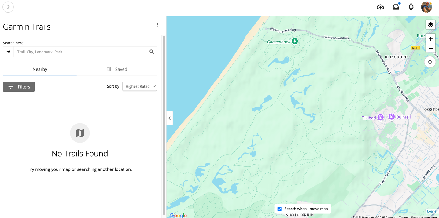
Still nothing (despite literally showing trails within the map). But that’s OK, I’ll go to one of the places I know best: The Alps, specifically around Chamonix Mont Blanc.
Finally, success! We have found routes (indicated by the blue dot, showing the number of routes in that area):
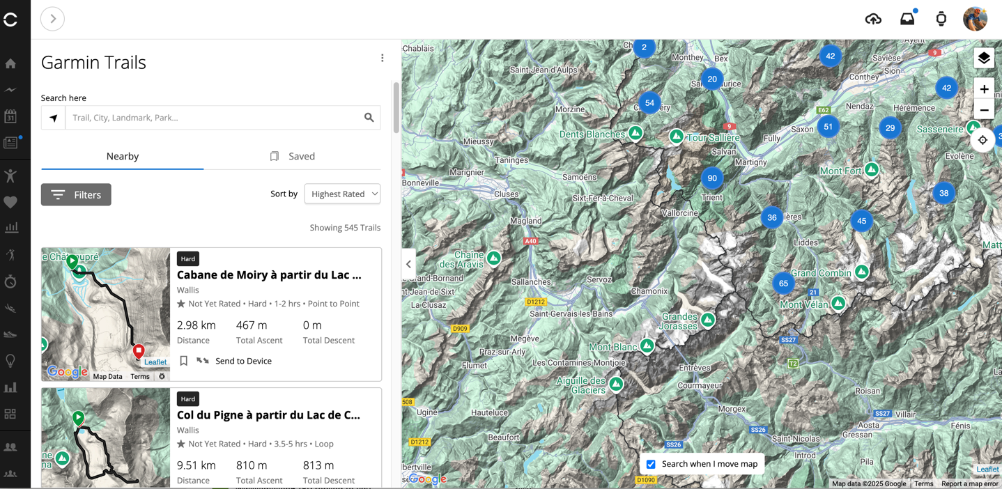
I’ll set aside the fact that the left-hand side of this map is oddly empty of little blue dots, while the right-hand side is populated. And when you zoom in, said left-side shows trails just fine. Here’s the main Chamonix valley, which includes 8 trails (all of which appear to basically be near identical variants of a single section of trail).
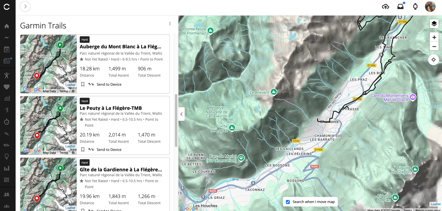
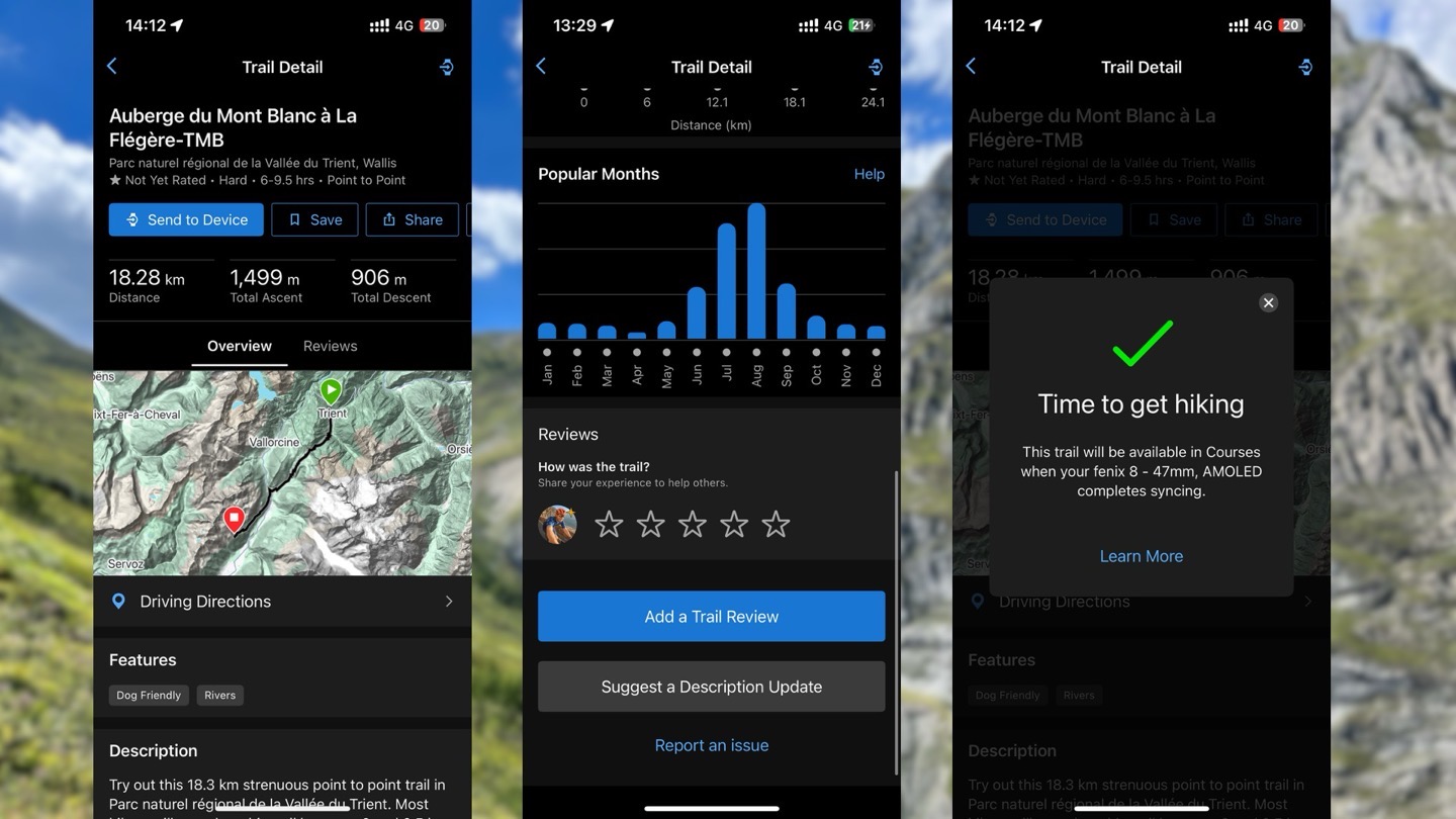
Looking at the first trail in the list, on the upper left side we’ve got some overview stats (seen below, left), and then we have a little snippet of descriptor text. While this seems AI generated, putting it through an AI-text-detector actually says it’s 100% human. Scrolling down we get more stats about this trail, including seasonality usage, obviously favoring the summer quite heavily.
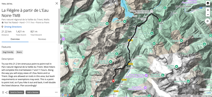
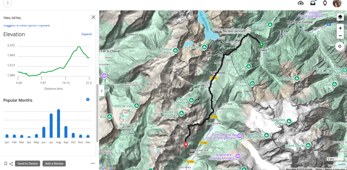
And yes, this is a trail (technically), and yes, the description is fine, and the stats are fine. But, this trail is not something anyone would hike as-is standalone.
I’ve hiked this specific trail section, a number of times, forwards and backwards. But, nobody would hike this trail as-is. To begin, this trail starts in Trient, a tiny little cutesy town that most hikers on the Tour de Mont Blanc would hike through. Here’s two photos from one of my hikes, from the exact spot this route starts.
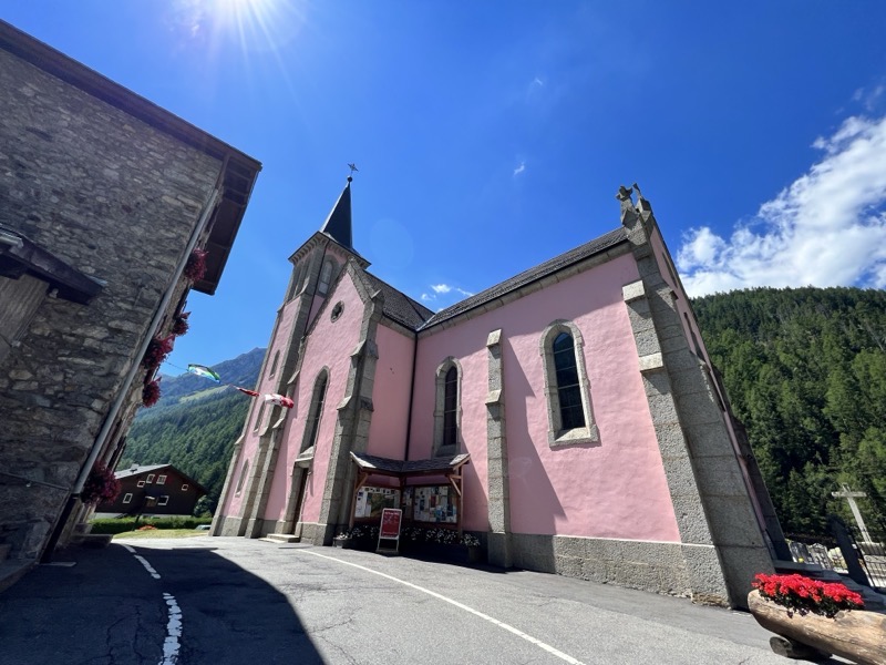
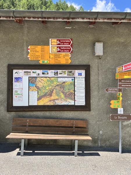
But nobody would actually leave Chamonix village to drive all the way here here, and start here (remember, I zoomed into Chamonix for my search). But setting that aside, we’ll start there. Once we begin, Garmin says it’ll take us 7-11 hours, that’s probably a bit high to be honest, given this escapes much of the complexity of going over the ridge behind Le Tour, but fine, we’ll go with it.
The issue is, the trail as Garmin has it, ends on the side of the mountain, nearly 1,000 meters above the valley floor. If you were to hike it, you’d then need to find your way back down to the base (you aren’t allowed to camp in this area, only considerably above it). If you waited till June 7th, you could take a cablecar down from this point (since that’s where the trail stops). But that cablecar ends at 15:45, and with a 7-11 hour hike, that means you need to be starting upwards of before 6AM. Or inversely, if we did this entire route backwards, then we’d have to get to the starting point (the cablecar doesn’t open till 9AM), putting us in a town with almost no transportation options at 7PM (it would take 3 bus connections through two countries, a bit over 3 hours to get back, according to Google Maps).
Look, there are *SO MANY* incredible trails from the base of Chamonix village. Dozens of popular ones, and countless other variations. It couldn’t identify/list a single trail round-trip or otherwise usable trail from the Chamonix village base – arguably the most popular outdoor hiking destination in all of Europe.
Now, let’s look more at the technical features here. There is the ability to filter trails by a bunch of different parameters:
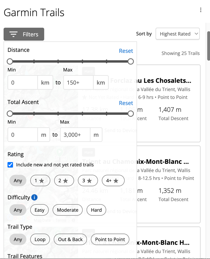
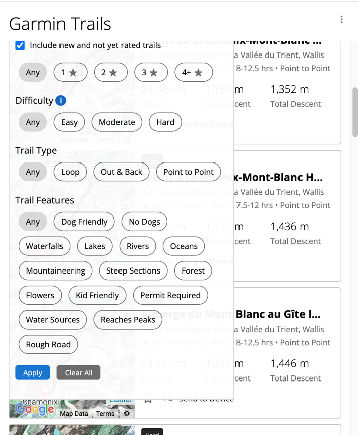
I think these filters do have validity in terms of utility and usefulness, but, it requires more underlying actual trails to become useful. For example, these parameters would be super useful with Strava Routes, where there are gazillions of trail options.
What’s puzzling to me though is that Garmin appears to be relying on some sort of manually curated trails here. Whereas they have this vast trove of automatic route generation pieces that they’ve used on both Garmin Connect and devices for years. And those automated (Round Trip Routes) actually tend to be really good, heavily dependent on Garmin Popularity map (heat map) data. It doesn’t seem like Garmin is leveraging any of that for the instantiation of the trail (perhaps just for the route duration portion).
Look, Garmin appears to be very committed to Garmin Connect+ being a core revenue stream going forward, just as Apple is with various Apple services. But Garmin has to find ways for these features to be fundamentally additive to the premium on-device experience, without feeling like they’re taking features that should be included for the premium Garmin device price. When I pay for Apple’s Fitness+, it’s paying for instructors/coaching. When I pay for Apple iCloud, it’s for the storage of all my silly photos (including the two I pulled from 3 years ago, for the photos above). All of those features have clear value props to me, because they’re executed well, and I can wrap my brain around why I’m paying extra for it (despite paying a premium for the Apple hardware it operates from).
I’m not convinced this new feature is currently providing that value to users, despite having the technical framework (filtering/etc) to do that well. Hopefully that changes.
With that, thanks for reading!
0 Commentaires